
For decades, the twin cities of Rawalpindi and Islamabad have faced severe traffic congestion. Heavy transport—carrying goods from Punjab to Khyber Pakhtunkhwa and beyond—has had no choice but to push directly through Rawalpindi’s tightest bottlenecks: Murree Road, Saddar, and the N-5 Grand Trunk (GT) Road.
The Rawalpindi Ring Road (RRR) project was designed to transform this setup. It serves not just as a arterial bypass, but as a catalyst for economic and urban development in northern Punjab.
What is the Rawalpindi Ring Road?
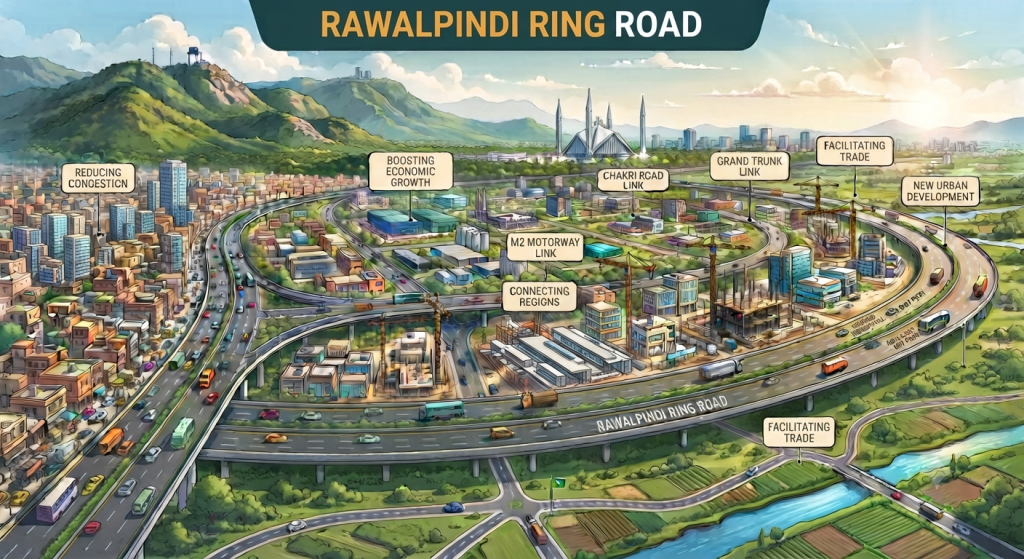
The Rawalpindi Ring Road is a 38.3-kilometer, six-lane controlled-access orbital highway. Overseen by the Rawalpindi Development Authority (RDA) and constructed by the Frontier Works Organization (FWO), it bridges the southern and western perimeters of the city.
- Starting Point: Baanth (near Rawat on the N-5 GT Road).
- Ending Point: Thalian Interchange (connecting directly to the M-2 Motorway and nearby CPEC routes).
- Key Interchanges: Baanth, Chak Beli Khan, Adiala Road, Chakri Road, and Thalian.
  [ N-5 GT Road / Baanth ]
             │
             ├──► Chak Beli Khan Interchange
             │
             ├──► Adiala Road Interchange
             │
             ├──► Chakri Road Interchange
             │
  [ M-2 Motorway / Thalian Interchange ]
Why the Ring Road is Critical for the Twin Cities
1. Relief from Urban Gridlock
Rawalpindi’s main arteries carry thousands of long-haul trucks, oil tankers, and intercity buses every single day. By providing a dedicated 6-lane bypass around the metropolitan perimeter, the project re-routes heavy freight away from inner-city roads. This cuts travel times for daily commuters and significantly reduces urban traffic bottlenecks.
2. Rapid Transit to Islamabad International Airport
Reaching the Islamabad International Airport from southern Rawalpindi or Lahore via the N-5 previously meant navigating intense city traffic. The RRR acts as a direct, high-speed corridor straight to the airport via the Thalian Interchange, dramatically simplifying logistics for travelers, cargo, and businesses.
3. Economic Corridor & Industrial Hubs
The project is framed as the Rawalpindi Ring Road Economic Corridor. Planned developments along the 500-meter zone on either side of the route include:
- Specialized industrial and logistics zones.
- Wholesale produce markets and dry ports.
- Educational and healthcare facilities designed to decentralized urban services.
By linking the N-5 GT Road with the M-1 and M-2 Motorways, it connects local supply chains directly into CPEC (China-Pakistan Economic Corridor) trade routes.
4. Real Estate Expansion and Urban Decentralization
Rawalpindi has long suffered from over-density in its core city center. The Ring Road effectively unlocks thousands of acres of suburban land along Adiala, Chakri, and Chak Beli roads.
- Planned Growth: Suburban housing projects and commercial developments now have direct connectivity to the wider motorways.
- Controlled Sprawl: It helps shift the city’s expansion toward planned, structured communities rather than congested urban pockets.
5. Environmental & Public Health Impact
Trapped traffic idling on urban roads emits massive volumes of exhaust and noise pollution. By keeping heavy diesel engines moving at constant highway speeds outside dense residential areas, the RRR contributes to cleaner air and reduced fuel consumption across the twin cities.
Key Takeaway: The Rawalpindi Ring Road is far more than a highway bypass. It serves as a structural reboot for the entire Rawalpindi-Islamabad region—shifting heavy transit outwards, modernizing trade logistics, and providing a foundation for sustainable city expansion.
Leave a thought 🤔 (0)
Be the first viewer to leave a thought!